|
This is a great walk for combining scenic riverside walking with all the history the ancient capital of Wessex has to
offer.
Getting to the start of this walk by car is easy, exit the
M3 at junction 11 and you'll find parking in one of two large laybys next to the old railway viaduct off the hockley
link road to the west of the motorway. The 69 bus will also get you there. This is where our walk starts.
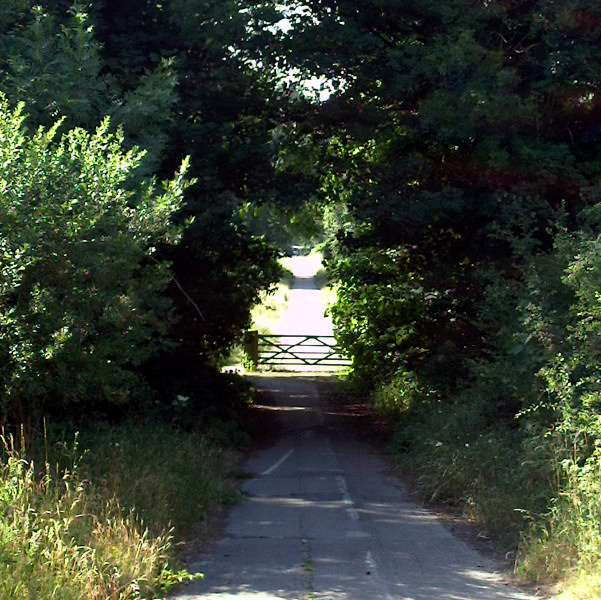
Walk towards the traffic lights following the pavement as
it veers into the bushes, at the junction with the old St Cross road turn left to pass between the piers of the demolished
railway bridge and through the gate. Heading in the direction of St Cross you'll pass over several river bridges with their
white railings. After a quarter of a mile or so take the track on your right towards St Cross Farm, then cross the two
stiles immediately ahead of you.
Follow the well defined path as you skirt the cricket pitch and St Cross hospital to your left and the grazing land and
river to your right, eventually bringing you out onto Garnier Road you must cross the bridge to continue on the path alongside
the river, which is now on your left. Also on your left you are able to admire the pristine playing fields and wonderful old
buildings of Winchester college.
The footpath brings you out onto a road which services the back entrance
to the college, follow this right handed and shortly at it's junction with College Walk turn left keeping the college wall
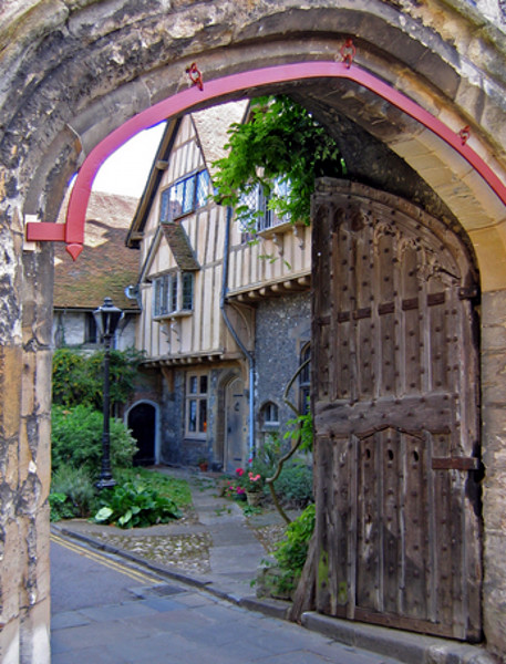
to your left as you bend to the left in front of Wolvesley Castle into College Street. Where the road bends left ninety
degrees to become Kingsgate street you must instead turn right beneath the ancient arch with it's little book shop, then turn
right again to pass through the arched wooden gates into the beautiful Cathedral Close.
Take plenty of time to look around here, there are few more beautiful man made environments than this in the whole world,
you can taste the past with every breath you take and everything is still very traditionally English here. Follow the road
left handed around the close towards the Southern elevation of the handsomely squat cathedral, keeping left handed you arrive
at the main entrance to the cathedral where in the summer people flock to picnic on it's greens, indeed we were here on the
first weekend in July, when every year Winchester has it's hat fair, a very popular event when the city streets are full of
visitors, market stalls and fabulously diverse entertainments you can watch for the cost of a few coins thrown into the performers
hat. It's like a giant mega busk with jugglers, musicians, acrobats and pretty much any other type of street entertainment
you can think of, well worth a visit.
Head along the front of the cathedral passing through the square with the pub The William
Walker to your left and entering Winchester's High St through the narrow little shop lined cutway . It's well worth
turning left here to walk up the pedestrianised High Street, passing the Butter Cross on your way and even perhaps continuing
through the traffic lights to the Great Hall, opposite the council offices, which houses King Arthur's round table "alledgedly" .
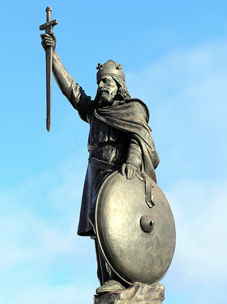
You may then return along the same route passing the shop lined cutway on your right to continue onto The Broadway with the
guildhall on your right and King Alfred's statue dead ahead.
Passing the roundabout the city mill spans the river Itchen but you must take the riverside path on the other side of
the road alongside the pub The Bishop on the Bridge. Walk through the splendid park keeping the river to your left until
you reach the residential road where a mill once stood (Granville Place) then keep right onto Wharf Hill and then left onto
Domum Road. Continue along the road and on your right you will see some gravel steps descend between the houses, descend these
and you arrive on the towpath for the glorious Itchen Navigation which you must follow.
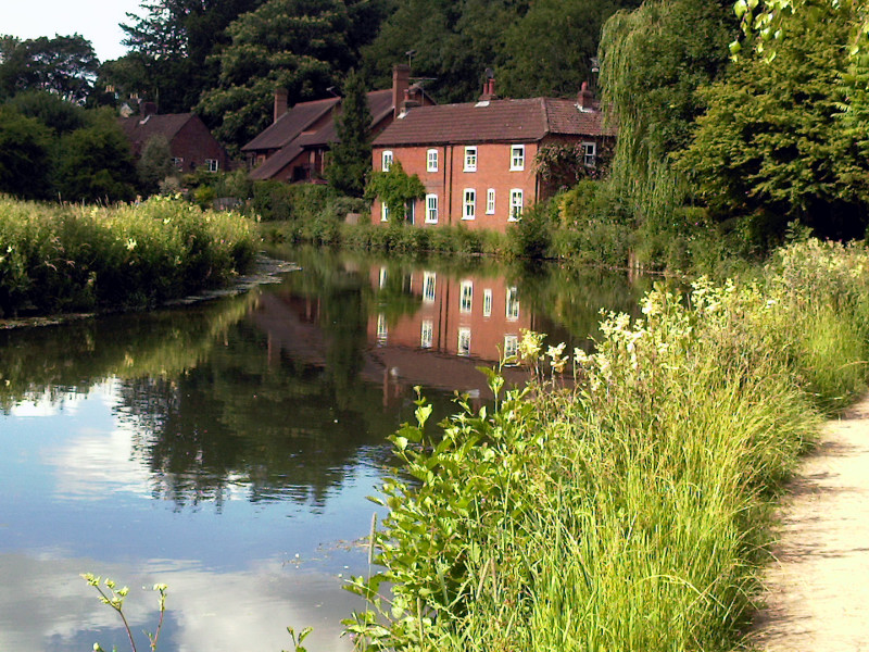
Follow the towpath as it bends with the river passing lovely riverside houses before winding through playing fields and
emerging beside a bridge on Garnier Road. Cross over keeping the river to your right and small gravel car park to your
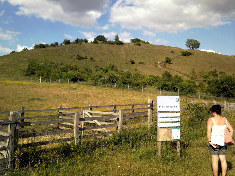
left to continue along the riverside tow path. The narrow little path rises to join a substantial rural cycleway which skirts
St Catherines Hill and the now invisible old railway and dual carriageway which used to run through here. Again if you have
the energy you're able to divert from the walk here to climb the steep hill at the top of which you will find a mizmaze (turf
maze) and superb views over the city. Alternately you could admire the scenery at the bottom of the hill by exploring Winchester's
Plague Pits where the cities dead were buried during the plague. Or if that doesn't tempt you you can always continue the
walk in a southerly direction along the cycleway.
Soon the cycleway passes under a well preserved brick railway arch which used to carry the old Didcot, Newbury and Southampton
Railway which closed along with many others under Dr Beechings axe in the 1960's. Finally you reach the junction with the
old St Cross road once again, from which you will remember it's only a short walk back to your car or bus. This walk terminates
here.
|


