This delightful little walk explores a corner of of Hampshire, known mainly to locals and horse riders. Here's your
chance to experience the pretty glades, wide views, and open fields which once formed part of the ancient Forest of Bere.
Why not take the opportunity to pop in The Fox for a drink or a bite to eat. Perfect for a relaxing Sunday stroll !
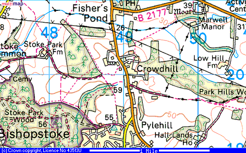
From Eastleigh town centre, cross the Bishopstoke railway bridge, on the B3037. Continue past Bishopstoke and The
River Inn, towards Fair Oak. At the traffic lights outside The New Clock Inn, turn left into Sandy Lane, continue passing
a parade of shops to your left, and after half a mile or so, turn left into Hardings Lane. Just past the entrance to Stoke
Heights, the lane loses it's tarmac to become gravelled. On the left is a small car park, or if this is full you may
backtrack and park considerately in Hardings Lane.
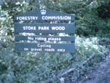
Follow the now gravel Hardings Lane entering the woods beside a five bar gate then follow the main gravel path
ahead of you. To your right is a kids BMX area and TV mast hidden in the trees. Continue down the path passing others,
rising and bending to the right. Soon another major path crosses yours as it bends to the left, continue forwards leaving
the wooden bench to your right. In a while you come upon what is known locally as the four way cross, here you contnue on
the main path, which is the third from the cross. Keep forward leaving another major path to your left.
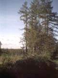
View over clearing at four way cross
Through the trees to the right you can glimpse flashes of green fields. Leave the main path to turn right when
you reach a wooden bench and descend through the dark pine woods towards a gap beyond which are the fields.
Staying inside the woods take the track to your left along the northern edge of the wood. The path soon forks, you must continue
right handed. At a small crossing turn right towards the edge of the field once more, then turning left follow the path
which soon becomes gravel, the woods dropping off sharply to your left. Keep forward dropping down some steps to cross
a small stream before climbing the bank via steps with a handrail the other side. The path here is lined with chestnut
trees and in the spring the woods are carpeted with bluebells. Ignoring the path to your left, keep forward until you emerge
onto a junction of paths, where you must turn right towards a gap in the wooden fence, through which you pass to
emerge into a field. Follow the well defined path through the field, until you reach the tarmac lane , which is Cemetary Lane.
The village to your left and ahead is the Stoke Common area of Bishopstoke.
Turn right along Cemetary Lane, passing a 1970's built semi detatched farm cottage on your left, and the
neatly kept, tree fringed cemetary on your right. The lane now loses it's tarmac, to become a substantial gravel farm track,
through the fields and then twisting first left then right, to become hedge bordered. On your left you pass a fish farm, and
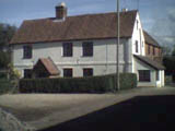
then ahead you get your first sighting of farm buildings at Stoke Park Farm. The track bends left past barns, then right again
in front of the farm house. continue, passing the milking parlour and more barns on your right, keeping the telegraph pole
to your left, ascend out of the farmyard on what is now a hedge lined track once more.
Stoke Park Farmhouse
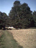
Eventually the path opens out at a junction with another path on the right. look out to your left and on
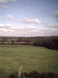
a clear day you can see Winchester across the open countryside.
Ignore the path on the right , keeping to your original track, passing a very
small plantation of trees, put there by farmer Dunford to replace the old Black Barn which once stood on the site. The woodland
Trust woodland now on your left still bears the name, Upper Barn Copse. To your right over the fields you can see Stoke Park
Woods and the TV mast.
open views to Winchester
Directly ahead of you the track bends sharp right at a horse paddock, then passing a gravel track to your
left, (The Fox 100 yds up this track on the right.), plunges back into the trees. To the right is the entrance to Crowdhill
Copse, enter the copse, and keep to the main path all the way through, leaving by the side of a five bar gate. Do not re-enter
Stoke Park Woods opposite, but instead turn left, to follow the edge of the woods and a field margin, passing the TV mast
and BMX area, to find yourself back at the wood entrance. Retrace your steps back along Hardings Lane to where you left
your car.