|
An eleven mile coastal walk, in this birdwatchers paradise.
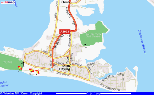
Fron the A27, take the Havant / Hayling junction, and head south to cross the bridge onto the island. Turn left immediately
before the garage, where parking can be found, in the gravelled lay-by, on the North shore.
Walk back to the main road and turn left, opposite the garage are the
remnants of an old road, walk along this and shortly on the right is a small path, leading you along the waterside, and up
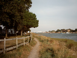
onto the old railway line, now known as The Hayling Billy path. Turn left onto it, then in a few yards on your right , ascend
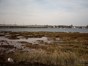
some steps onto the Langstone Harbour Walk. The saline lagoons on your right are the old oyster beds, and a birdwatchers paradise.
Continue to follow the shore until you rejoin Hayling Billy at a small car park.
Continue south, to the end of the line, at the old station, now a theatre. Cross over the road, and carry on ahead along
Staunton Avenue. At its' end, cross over the Seafront road, and head towards the beach huts. On reaching the huts, turn left
to walk along the beach, until you reach Beachlands Cafe and funfair. Here , (after a revitalising mug of tea), go between
the two and across the roundabout, to the Seafront road once more, turning right.
On a clear day, the Isle of Wight, Nab Tower, and at least one ship, usually can be seen.
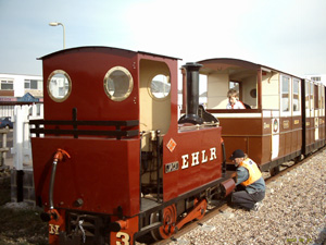
Presently you will arrive at the narrow guage railway station, and shops, here the road bends to the left, and then on
the right is Southwood Road, go down here and then turn left into St Hermans Road. Look for a bungalow aptly named "Creek
End", and follow the path alongside. Emerging onto Fishery Creek, follow the path, with a mobile home park on one side and
the creek on the other.
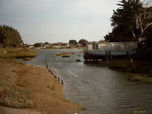
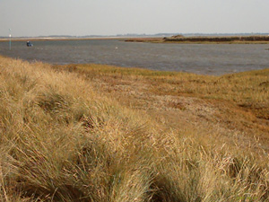
As you continue along the waters edge, you will pass Fishery Creek Caravan Park, a pond, world war two pill box, and
going through the boatyard with Mengham Salterns on your right, will eventually emerge onto Marine Walk. this leads onto Salterns
Lane, where opposite its' junction with Rails Lane, is a footpath on your right.
Follow the footpath through the horse fields, across the end of a tarmac cul-de-sac and continue to the left of a wall,
passing another footpath on ther left, and eventually joining the pleasant residential Beech Grove. At the end of the road
turn right into Tournerbury Lane, then turn left into Eastwood Close and follow the hedge lined path with a golf course to
the right, and later school playing fields on the left.
On meeting the Mill Rythe holiday village access road, turn left, pass under the arched gateway and turn right onto the
Havant road. You will pass "The Maypole" pub on the left, and a little further on turn right into Yew Tree road, passing the
garden of the Yew Tree pub with its' pot bellied pig and then turning right into Copse Lane.
Opposite the Broad Oak Hotel, is a footpath which passes close by the Fleet Farm
Caravan Park, and leads down to another creek.
The path follows the edge of the creek, through a ramshackle, corrugated iron roofed boatyard, and past the long gardens
of large houses, before ducking inland under scrub, and turning left along a flint knapped wall, at the end of which turn
left then right into Woodgason Lane. At the Meadow Farm Nursery junction with Copse Lane, turn right. The road soon becomes
St. Peters Rd and enters Northney village.
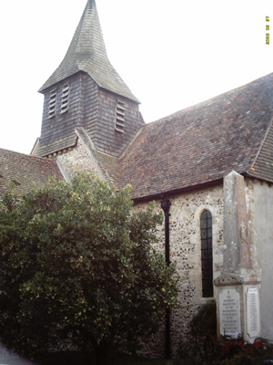
At St. Peters Church, enter the graveyard and take the gravelled path on the right then left into the church car park.
On your right a gate leads into a field, keep to the edge of the field as it passes a bungalow and trees,before reaching Northney
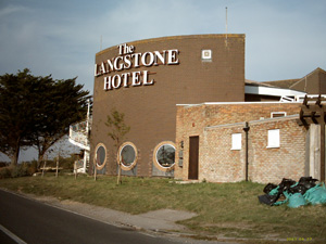
Rd. Turn left and follow the road past the Langstone Hotel, as it bends left to follow the shoreline back to your car.
|